hawaii part 4
day 8 we went scuba diving with south kona scuba. our dives were off the shore near puuhonua o honaunau (aka city of refuge). this was our 3d and 4th dives, and so we are still getting used to the whole elvin-magic breathing under water trick. i must say, though, it is an amazing experience. worth trying at some point in your life. i saw an eel poke its head out of a coral reef. and, we saw a sea turtle down deeper. and coral. and fish.
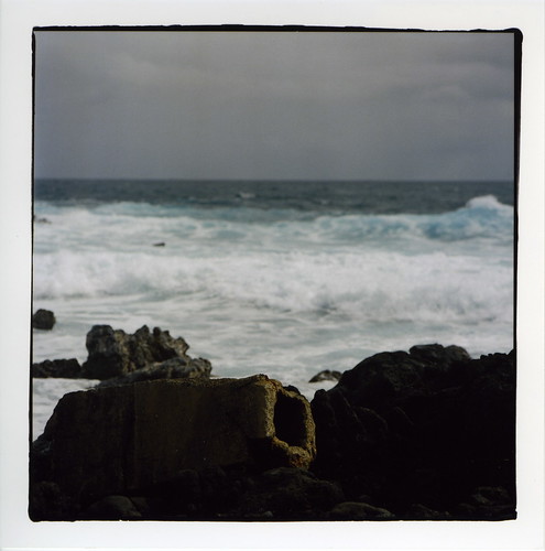
we mostly chilled the rest of the day. and visited a beach near sunset. from the beach, we saw what looked like a whale tail - it flipped up 10+ times in a row. so we tried to book a whale watching tour for day 9. the only time we could get, however, was early morning the day we were leaving.
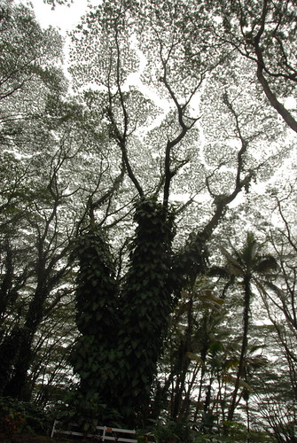
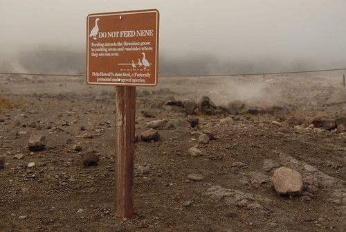
day 9 we visited puuhonua o honaunau national historical park (aka city of refuge).
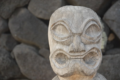
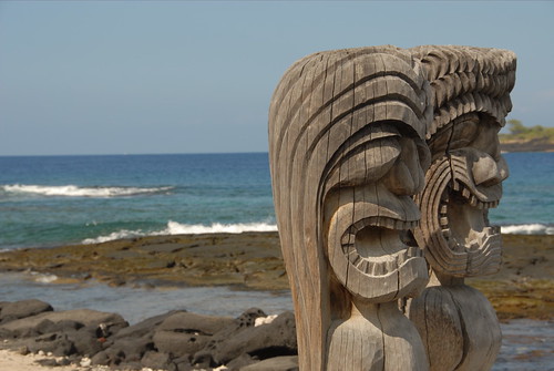
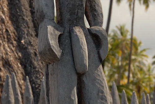
the guidebook says these are modern carved effigies of gods
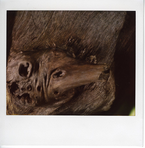
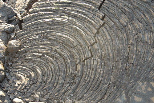
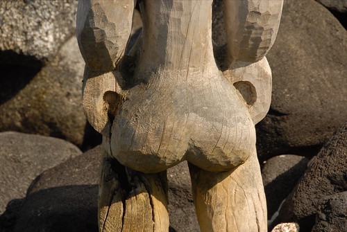
i found some interesting details that the brady bunch failed to highlight
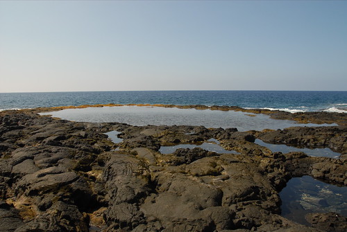
the guidebook says this spot held the royal palace and a puuhonau sanctuary. my understanding is that certain things were kapu - forbidden - by hawaiian law/custom. for which, the punishment was death. if you made it to a sanctuary, you would be absolved. however, you had to get past the armed warriors (of the royal palace) and/or make it by sea (the guidebook mentions shark infested waters).
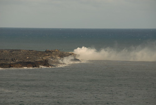
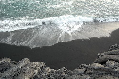
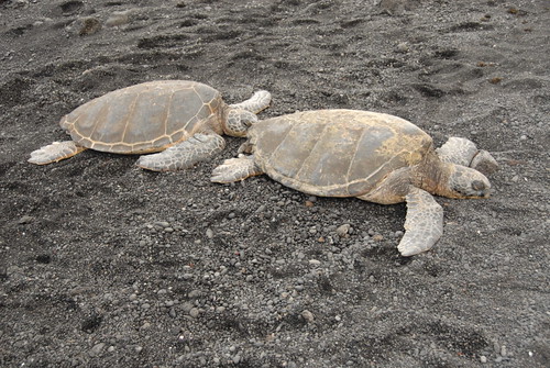
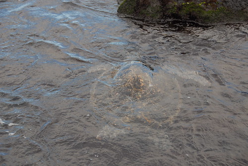
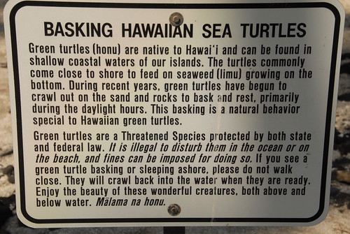
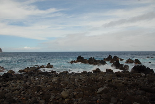
we saw more basking sea turtles. and a nice place to chill with the ocean.
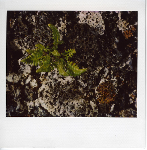
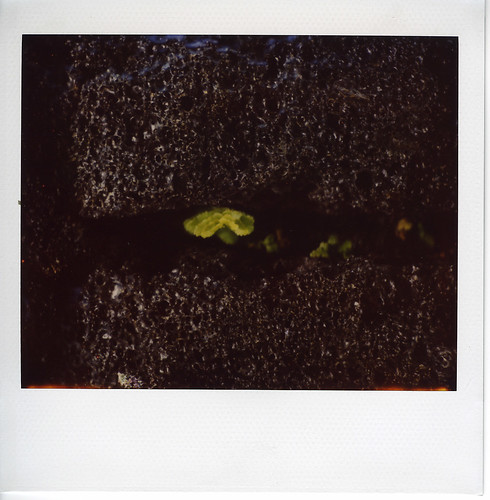
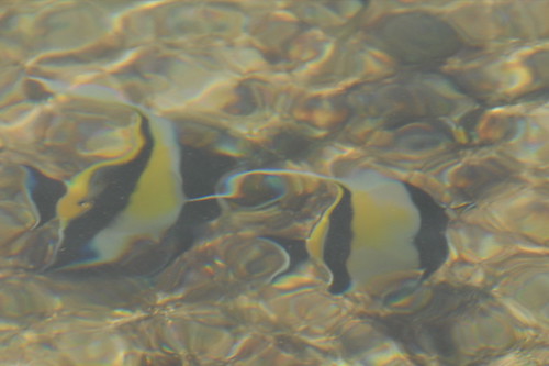
and look for fish
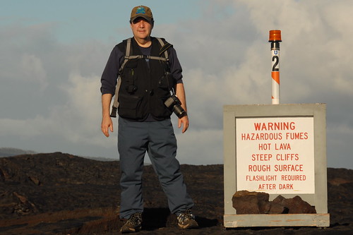
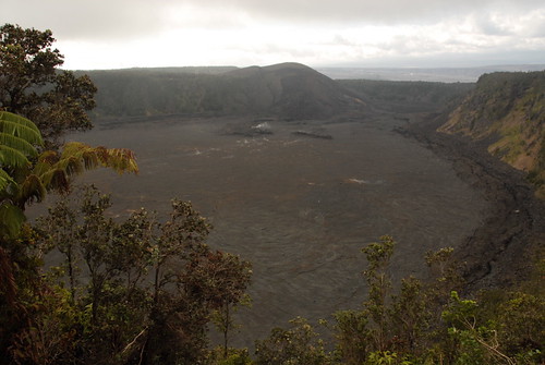
we then went to mauna kea - a dormant volcano with a peak of 13,796 feet above sea level (plus 19,678 feet below sea level, since it starts on the ocean floor).
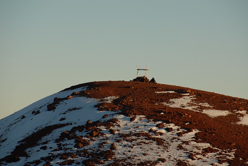
with a 4wd, you can drive to the top, where they have a bunch of observatories.
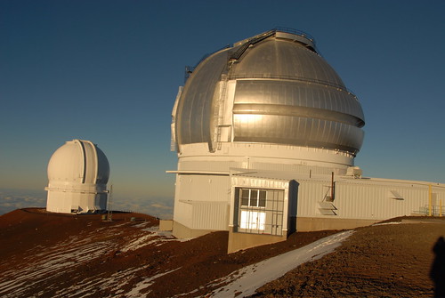
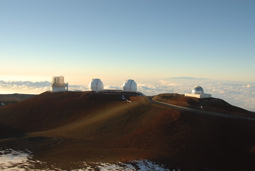
we learned that the big island is perfect for the observatories because: (1) hawaii is isolated from other land masses, so the wind is more calm; (2) light pollution is minimized due to distance to cities, special street lamps the cities use, and the fact that clouds often box in the city light; (3) hawaii is close to the equator, which is better for seeing more of the sky; and (4) the atmosphere is thinner at the top.
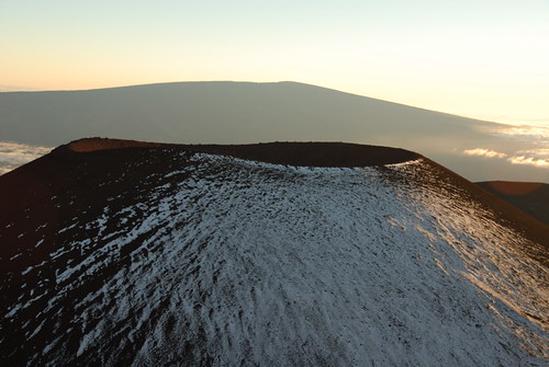
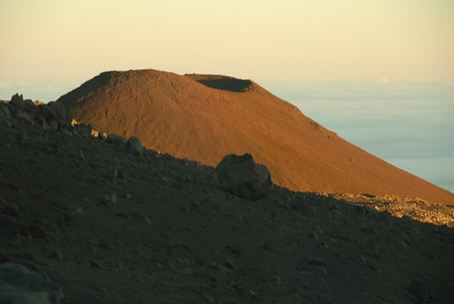
and you can see a bunch of cone shaped peaks (some laced with snow) for the volcano.
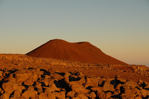
it is cold, and you cannot go into the observatories there, but it is nice to see.
down the road a bit, the ellison onizuka visitor center has telescopes set up for star gazing and a volunteer points out some interesting bits in the sky. check the weather - we visited our first night and it was cloudy. on this night, it was cloudy until we got to the visitor center and we had a sparkly clear sky to see. it was beautiful. and, we learned that the visitor center is a better place for people to star gaze because the lower atmosphere up top makes people dizzy.
day 10 we left our house early (6am) to go whale watching. humpback whales retreat to hawaii in the winter and kona is a good place for whale watching.
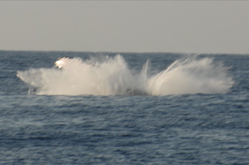
we saw a few whales breach.
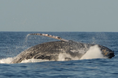
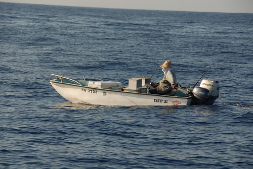
as did this person in the small boat
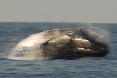
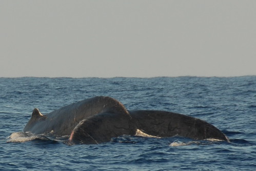
we saw a bunch of whales not breaching
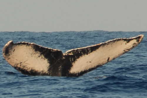
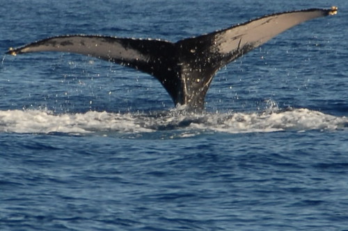
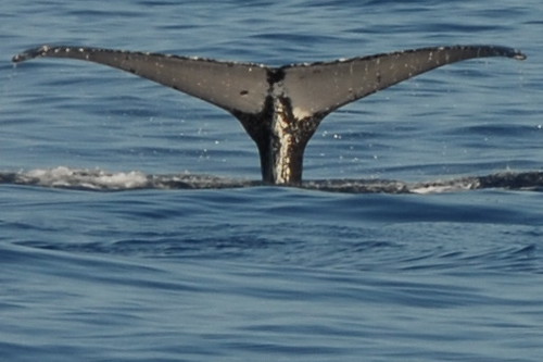
and learned that you can identify hunchbacks by their tails
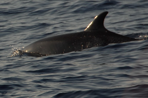
we also saw some dolphins
(view the whole whale watching slideshow)
then, after lunch on the beach, we caught an early afternoon flight back to sf.
we mostly chilled the rest of the day. and visited a beach near sunset. from the beach, we saw what looked like a whale tail - it flipped up 10+ times in a row. so we tried to book a whale watching tour for day 9. the only time we could get, however, was early morning the day we were leaving.
day 9 we visited puuhonua o honaunau national historical park (aka city of refuge).
the guidebook says these are modern carved effigies of gods
i found some interesting details that the brady bunch failed to highlight
the guidebook says this spot held the royal palace and a puuhonau sanctuary. my understanding is that certain things were kapu - forbidden - by hawaiian law/custom. for which, the punishment was death. if you made it to a sanctuary, you would be absolved. however, you had to get past the armed warriors (of the royal palace) and/or make it by sea (the guidebook mentions shark infested waters).
we saw more basking sea turtles. and a nice place to chill with the ocean.
and look for fish
we then went to mauna kea - a dormant volcano with a peak of 13,796 feet above sea level (plus 19,678 feet below sea level, since it starts on the ocean floor).
with a 4wd, you can drive to the top, where they have a bunch of observatories.
we learned that the big island is perfect for the observatories because: (1) hawaii is isolated from other land masses, so the wind is more calm; (2) light pollution is minimized due to distance to cities, special street lamps the cities use, and the fact that clouds often box in the city light; (3) hawaii is close to the equator, which is better for seeing more of the sky; and (4) the atmosphere is thinner at the top.
and you can see a bunch of cone shaped peaks (some laced with snow) for the volcano.
it is cold, and you cannot go into the observatories there, but it is nice to see.
down the road a bit, the ellison onizuka visitor center has telescopes set up for star gazing and a volunteer points out some interesting bits in the sky. check the weather - we visited our first night and it was cloudy. on this night, it was cloudy until we got to the visitor center and we had a sparkly clear sky to see. it was beautiful. and, we learned that the visitor center is a better place for people to star gaze because the lower atmosphere up top makes people dizzy.
day 10 we left our house early (6am) to go whale watching. humpback whales retreat to hawaii in the winter and kona is a good place for whale watching.
we saw a few whales breach.
as did this person in the small boat
we saw a bunch of whales not breaching
and learned that you can identify hunchbacks by their tails
we also saw some dolphins
(view the whole whale watching slideshow)
then, after lunch on the beach, we caught an early afternoon flight back to sf.
posted by billy ocallaghan at 11:00 AM
1 comments
![]()
![]()